Post by bassboy1 on Dec 8, 2009 20:26:45 GMT -1
Coordinates have been confirmed and updated!
'Tis clear that nobody has been fishing them, as surely someone would have pointed out that one of the coordinates (#14) happened to take you to a stump on shore.
Anyway, as many of y'all may know, I am a Life Scout in BSA Troop 15. For my Eagle Scout project, I sought after something I could do to help the lake, or more importantly, the fish population in the lake. Mike Bucca finally came to my aid, and mentioned one thing this lake really needs - deepwater fish habitat. So, fast forward a few months, I am all cleared through USACE and DNR to place 15 of these piles in certain locations around the lake. 14 of these piles are currently in place, and the 15th one will be soon. All piles are now placed.
These piles consist of a tree (mostly sweetgum), or three, from the shoreline, lashed to cylinders of concrete, sunk at around 32 ft. at summer pool. Upon completion of the project, the coordinates will also be posted on the Georgia DNR's website, as well as a brief mention on other local fishing boards.
The coordinates for the piles are as follows:
1) Outside Glade Marina
N34* 7.398'/W84* 42.326'
2) Under the big houses between Glade and Redtop (what is that area called?)
N34* 7.879'/W84* 43.309'
3) Red Top Beach
N34* 8.944'/W84* 42.993'
4) Left of Dam
N34* 9.369'/W84* 43.415'
5) Left of Dam
M34* 9.468'/W84* 43.386'
6) Coopers Creek
N34* 10.169'/W84* 43.791'
7) Coopers Creek
N34* 10.394'/W84* 43.775'
8) Mckaskey Camp
N34* 11.398'/W84* 42.718'
9) Stamp Creek
N34* 10.539'/W84* 41.299'
10) Stamp Creek
N34* 10.850'/W84* 41.587'
11) Clear Creek
N34* 9.722'/W84* 41.347
12) Clear Creek
N34* 34* 9.893'/W84* 41.116'
13) Across from Galts
N34* 8.535'/W84* 38.899
14) Galts Clear Cut
N34* 8.645'/W84* 38.515
15) Galts Clear Cut
N34* 8.559'/W84* 38.307
Bear with me - a couple of these piles may not be on the coordinate, but will be close. One of the boats I was working with only had a handheld GPS, and no sonar, other than a depth sounder, so placing these trees was a crapshoot - the depth should be about spot on, with all of them, but the locations may be within a few ft. radius of the actual coord. If someone with SI happens to notice one of the trees off the coordinates, please send me a PM with the correct coordinate, and I will correct the above list. Three that I expect to be a little off will be #3, #7, and #10.
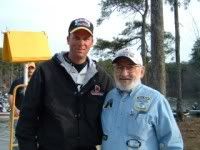
I would like to thank Mike Bucca for all the time he spent in helping me plan this, especially in placing the piles where they will actually hold fish ;D. He spent much more of his time helping me with this project than many, especially those as busy as him, would have.
A big thanks to RickyK for arranging to make me the concrete cylinders needed for this.
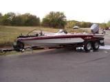
Thanks to Leapnlineman, Soretoe and Bob Smith for showing up with their boats and helping me pull these, even when the brushpile tried to make the better of them. And to pbmang for taking a Side imaging shot, and confirming the GPS location of each pile.
Thanks to Christie over at Nature's Tackle Box for agreeing to aid me with the fundraising for this project, which will hopefully happen after the first of the year.
Big thanks to Terrell Stoves for being my contact with USACE, and going well beyond the extra mile, often on his off days, in helping get approval from the higher ups in the Corps. And to Jim Hakala for being my contact with the DNR.
'Tis clear that nobody has been fishing them, as surely someone would have pointed out that one of the coordinates (#14) happened to take you to a stump on shore.

Anyway, as many of y'all may know, I am a Life Scout in BSA Troop 15. For my Eagle Scout project, I sought after something I could do to help the lake, or more importantly, the fish population in the lake. Mike Bucca finally came to my aid, and mentioned one thing this lake really needs - deepwater fish habitat. So, fast forward a few months, I am all cleared through USACE and DNR to place 15 of these piles in certain locations around the lake. 14 of these piles are currently in place, and the 15th one will be soon. All piles are now placed.
These piles consist of a tree (mostly sweetgum), or three, from the shoreline, lashed to cylinders of concrete, sunk at around 32 ft. at summer pool. Upon completion of the project, the coordinates will also be posted on the Georgia DNR's website, as well as a brief mention on other local fishing boards.
The coordinates for the piles are as follows:
1) Outside Glade Marina
N34* 7.398'/W84* 42.326'
2) Under the big houses between Glade and Redtop (what is that area called?)
N34* 7.879'/W84* 43.309'
3) Red Top Beach
N34* 8.944'/W84* 42.993'
4) Left of Dam
N34* 9.369'/W84* 43.415'
5) Left of Dam
M34* 9.468'/W84* 43.386'
6) Coopers Creek
N34* 10.169'/W84* 43.791'
7) Coopers Creek
N34* 10.394'/W84* 43.775'
8) Mckaskey Camp
N34* 11.398'/W84* 42.718'
9) Stamp Creek
N34* 10.539'/W84* 41.299'
10) Stamp Creek
N34* 10.850'/W84* 41.587'
11) Clear Creek
N34* 9.722'/W84* 41.347
12) Clear Creek
N34* 34* 9.893'/W84* 41.116'
13) Across from Galts
N34* 8.535'/W84* 38.899
14) Galts Clear Cut
N34* 8.645'/W84* 38.515
15) Galts Clear Cut
N34* 8.559'/W84* 38.307
I would like to thank Mike Bucca for all the time he spent in helping me plan this, especially in placing the piles where they will actually hold fish ;D. He spent much more of his time helping me with this project than many, especially those as busy as him, would have.
A big thanks to RickyK for arranging to make me the concrete cylinders needed for this.
Thanks to Leapnlineman, Soretoe and Bob Smith for showing up with their boats and helping me pull these, even when the brushpile tried to make the better of them.
 And to pbmang for taking a Side imaging shot, and confirming the GPS location of each pile.
 Thanks to Christie over at Nature's Tackle Box for agreeing to aid me with the fundraising for this project, which will hopefully happen after the first of the year.
Big thanks to Terrell Stoves for being my contact with USACE, and going well beyond the extra mile, often on his off days, in helping get approval from the higher ups in the Corps. And to Jim Hakala for being my contact with the DNR.


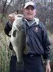


 . Been whacking fish on a few of them
  just kidding